
The Mysterious Case Of 'Phantom' Island: Sandy Island That 'Disappeared' On Google Maps In 2012

A phantom island is a purported island which was included on maps for a period of time, but was later found not to exist. They usually originate from the reports of early sailors exploring new regions, and are commonly the result of navigational errors, mistaken observations, unverified misinformation, or deliberate fabrication. Some have remained on maps for centuries before being "un-discovered."
Some may have been purely mythical, such as the Isle of Demons near Newfoundland, which may have been based on local legends of a haunted island. The far-northern island of Thule was reported to exist by 4th century BCE Greek explorer Pytheas, but information about its purported location was lost; explorers and geographers since have speculated that it was the Shetland Islands, Iceland, Scandinavia, or possibly nonexistent. The island of Hy-Brasil was sometimes depicted on maps west of Ireland, but all accounts of it have been fanciful.
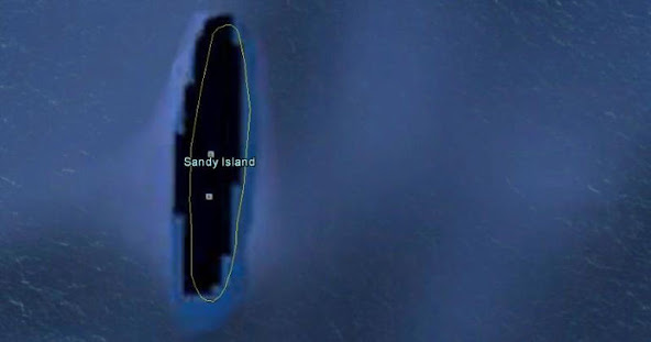
Sandy Island appeared on maps of the Coral Sea beginning in the late 19th century, between the Chesterfield Islands and Nereus Reef near New Caledonia, but was "undiscovered" in the 1970s. Nonetheless, it continued to be included in mapping data sets into the early 21st century.
A strange strip of land, known as Sandy Island, has been charted since 1774 as being located in New Caledonia in the South Pacific. But it has remained an enigma for many years.
Sandy Island became a subject of intrigue and in 2012, scientists headed to the area to find for themselves if there was any such island. To their surprise, they found nothing but blue waves of the sea.
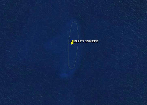
The Australian scientists on the R/V Southern Surveyor “undiscovered” the island, finding nothing but the sea,
Scientists headed to the area and recorded ocean depths to be more than 4,300 feet, suggesting there was no chance of anything lurking beneath the water that would previously have been visible.
"We wanted to check it out because the navigation charts on board the ship showed a water depth of 1,400 metres (4,620 feet) in that area – very deep. It's on Google Earth and other maps so we went to check and there was no island," Maria Seton, of the University of Sydney, told AFP
There is no official explanation as to why several sightings of Sandy Island have been seen over the years, but many experts believe that the island may have been the floating remains of a submerged volcano or coastal subaerial eruption.
Post a Comment
Please do not enter any SPAM link in comment box.